
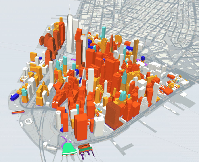
Launched by the Alliance for Downtown New York, a free interactive 3-D map (dubbed LM3D) uses real-time data to show all current and development projects one-square-mile south of Chamber Street. Although it may seem very specific, Lower Manhattan is the third largest central business district in the United States. The map will display all residential, office, retail, and hospitality developments, as well as open space and transit.
Users can view information on individual buildings, select specific areas to learn about land use, building and unit counts, identify key corridors, see upcoming developments, and sort between residential, hotel, office, transportation, institutional, retail, and restaurant services.
By the end of the year, LM3D should also provide historic data on the area’s development. The map is in beta and currently accessible through the latest versions of Chrome, Firefox, or Safari browsers.
Learn more by watching this how-to video:
