Seven years after Frank Gehry was approached by River LA to reimagine the 51-mile-long stretch of waterway, and four years after the Los Angeles County Board of Supervisors officially set the project in motion, the county has revealed a draft update to the L.A. River master plan.
The completed 2020 draft, released on January 13 and open to the public for comment through March 14, presents a sweeping overhaul intended to both buffer flood protection and provide open parkland for the one million residents who live within one mile of the river—without displacing lower-income Angelenos.
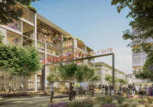
The draft master plan, the first update since 1996, is the result of extensive community surveys and in-person outreach. The river cuts through 17 neighborhoods and the design team, comprised of Gehry Partners along with landscape architects OLIN and engineering firm Geosyntec, were tasked with both creating site-specific installations, crossings, trails, flood mitigation measures, and landscaped platforms, as well as kits-of-parts and common design elements to create a unifying vernacular.
Frank Gehry, who famously said that uncapping the lower portions of the L.A. River would “never happen,” has seemingly been vindicated in the draft plan by the project’s hydro engineers:
Many have asked if we can remove the concrete from the LA River to return it to a more naturalized river. Because a more naturalized river requires a much wider flow path than the existing channel allows, it is not feasible to remove the concrete from the LA River without causing significant negative impacts to communities and local culture. Without displacing hundreds of miles of transportation routes and utility corridors, thousands of businesses, and potentially hundreds of thousands of residents, removal of concrete is difficult to accomplish.
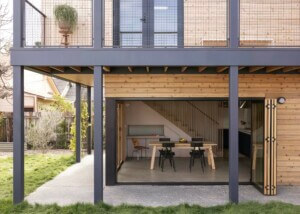
Planting the river “bed” and sides would have the same effect of slowing down water flow, so, in a Los Angeles Times interview released on January 11, Gehry revealed plans for a series of elevated platform parks. In South Gate, where the L.A. River and Rio Hondo, a tributary, meet, for instance, he proposed nearly a mile of elevated parks, cemented by a new $150-million cultural center where local children could gather. While elevated platforms would only obscure, not replace, a concrete channel famously referenced in numerous movies, television shows, and video games, they would still go a long way towards creating new public parkland. Whether that could happen is of course dependent on funding, but it’s also just one small piece of what’s expected to be a comprehensive overhaul.
Enhanced wayfinding, additional opportunities for education, expansive plans for stormwater capture and purification in the surrounding areas before runoff hits the river channel, and enhanced aquifer management are just a few of the targets for the plan’s 78 significant projects, although critically, a price hasn’t been released yet.
Urbanize L.A. points out that L.A. County officials are hoping funding can be appropriated from other, already-approved climate and homeless services-related budget measures, and with the incoming Biden administration looking to ramp up infrastructure spending nationwide, it’s hopeful that money will be diverted to realizing the 25-year roadmap.
It’s important to note, however, that the master plan organizers have no legal authority over land use, another hurdle the county would have to jump for reclaiming privately-held parcels surrounding the river.