In the minds of many coast dwellers, the American middle exists only in reference to their own condition: flyovers, breadbaskets. Middle-ness isn’t a state of being in and of itself but rather an aberrated refraction of the coasts’ sparkling prisms. For those who live in the middle, their existence and identities are fractured between geography, industry, and policy, while being outwardly lumped into regionalisms: the Midwest, the heartland. At this year’s Exhibit Columbus (Indiana, that is), which runs from August 21 to November 28, curators Mimi Zeiger and Iker Gil chose the curatorial theme “New Middles” to explore the conditions of middle places and middle-ness itself.
Zeiger and Gil define the middle by the Mississippi watershed: the 2,350-mile-long river drained by tributaries that occupy 1.2 million square miles, across 32 states. Though the exhibition will address broader themes within the watershed, like indigenous and Black histories in Columbus’s regional past, several of this year’s participants are addressing the watershed itself as an ecological condition of the middle. By doing so, Exhibit Columbus is positing that the characteristics of middle-ness describe an interconnectedness of ecosystems controlled by structures, systems, and ideologies that govern the built environment.

“We’re thinking of the watershed as both something real and as a metaphor,” said Zeiger. “Columbus is connected to the Flatrock River, to the Ohio River, then to the Mississippi, so the interconnection to the watershed is literal. And given that what happens upstream is connected to what happens downstream, there’s a metaphor of interconnection.” Occupying only a sliver of this region, Columbus’s 30-square mile footprint and its stock of notable modernist architecture become a starting point for dissecting the watershed itself, as well as metaphoric connections between the city and surrounding ecosystems of land and water, and infrastructure to maintain them.
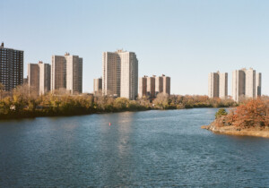
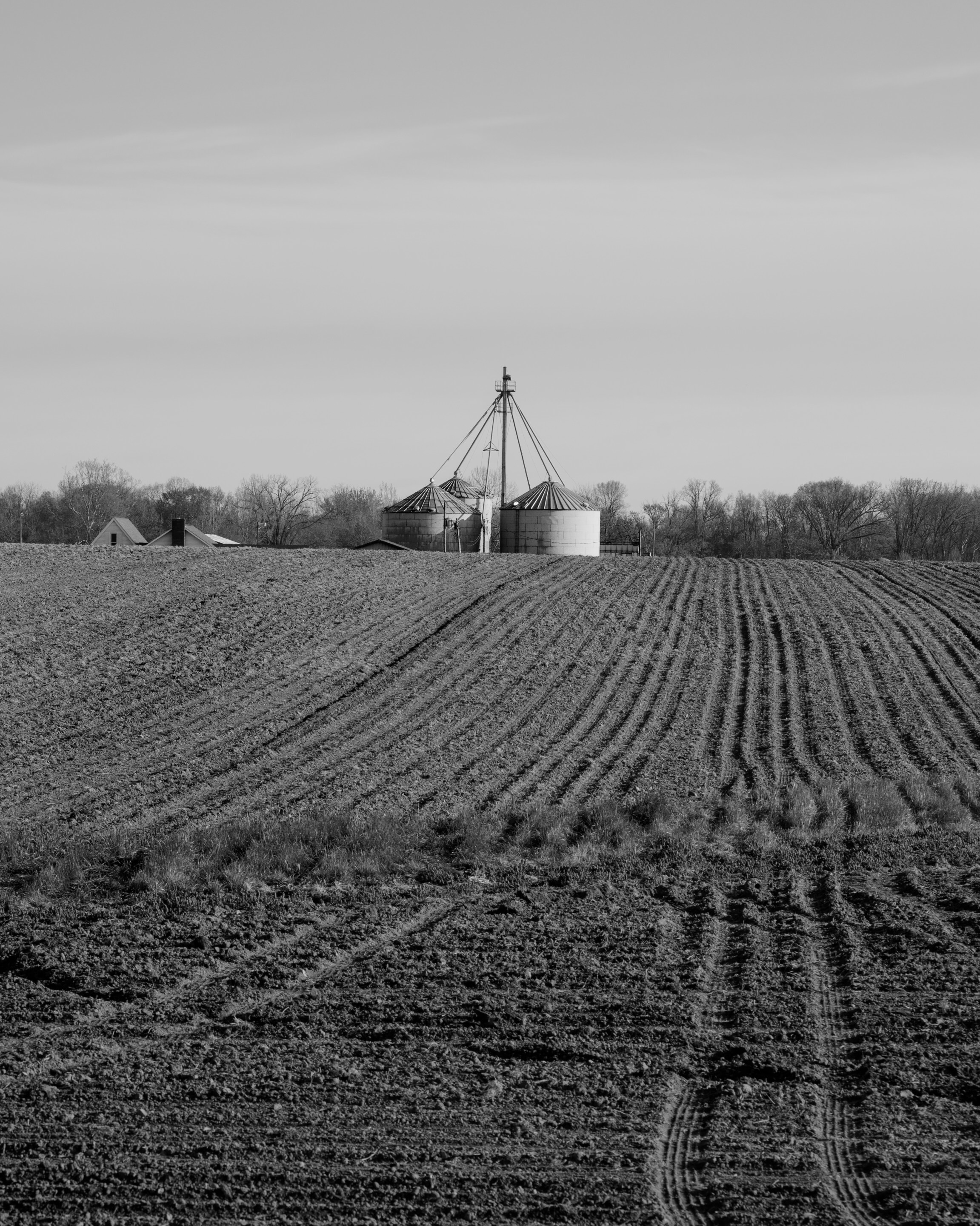
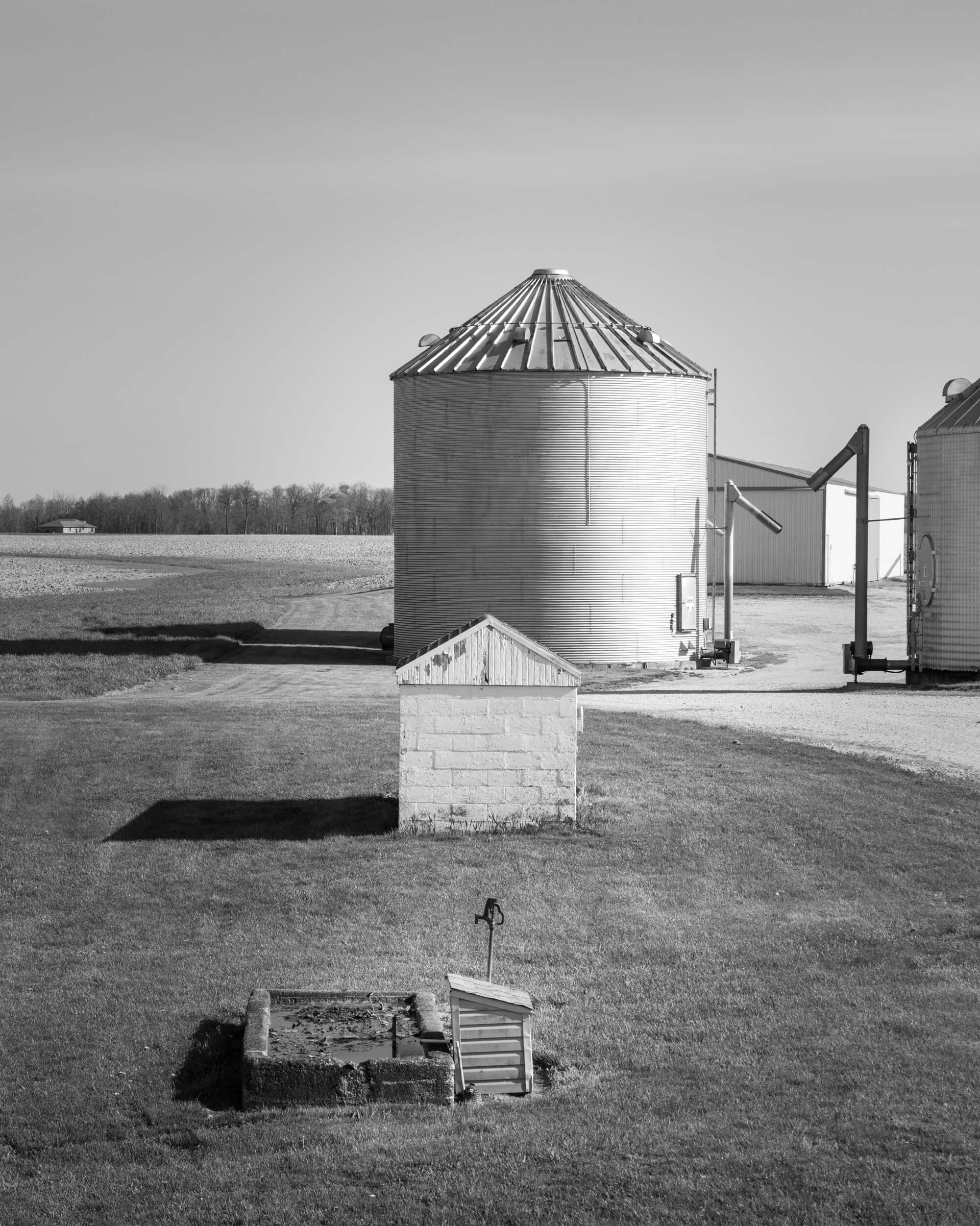
The 2021 Exhibit Columbus Photography Fellows, Virginia Hanusik and David Schalliol, work at opposite ends of the watershed—Hanusik in New Orleans and Schalliol in Minneapolis—but both explore how ongoing systems development (infrastructure, flood plains, food systems, etc.) connects middle dwellers across multiple regions. Their work at Exhibit Columbus will be displayed in storefronts, on garage doors, and in alleyways throughout the city.
Hanusik’s photographs are striking contrasts between the monumental scale of water management infrastructure on the southern coast of Louisiana and the gentle landscapes in which it sits. An image of weathered wooden needles from the Bonnet Carré Spillway or of an industrial canal levee memorial plaque placed in New Orleans’s Ninth Ward after Hurricane Katrina points to the heavily engineered, albeit extremely fragile objects that regulate environments—and are increasingly failing to do so under climate change.
“I’m creating these projects as a means of understanding the landscape and the larger issues around climate change and landscape transformation,” said Hanusik. “I started these projects that focus on the architecture and infrastructure of the region as a way to see them as symbols of our values and how we organize space.”
For the exhibition, Hanusik expanded her body of work beyond the Gulf Coast. She traveled north to photograph Decatur County, Indiana (neighboring Columbus’s Bartholomew County), as a way of pointing toward upstream challenges like farmland runoff contaminating the Mississippi River, which creates “dead zones” for sea life in the Gulf; her photographs of Cairo, Illinois, at the confluence of the Ohio and Mississippi Rivers remind viewers of dammed or leveed waterways that protect upriver farmland at the expense of communities near and far. Watershed infrastructure, she posits, dictates what—and who—bears the brunt of worsening flooding, and what (or who) is worth maintaining.
“I’m thinking about how these decisions around water management, as they relate to agriculture, infrastructure, and logistics—how those decisions way far upstream have consequences farther down that you go,” said Hanusik. “The project is about the ways that the Mississippi River has been altered and controlled over time, and how we’re feeling those impacts in Louisiana now.”
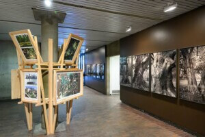
Derek Hoeferlin, architect and Exhibit Columbus University Design Research Fellow, also examines the scale of human impact on the watershed with Tracing Our Mississippi, an interactive installation and public programming series that expands upon his ongoing watershed atlas research project. The atlas displays systems like dams, levees, and transmission lines layered upon other sets of information like forested areas, contested lands, and resource extraction landscapes. “Ultimately, the themes narrate complicated issues across the Mississippi watershed at multiple scales and emphasize one objective: The relentless control of the Mississippi’s landscapes for developmental gain,” said Hoeferlin in his 2020 Exhibit Columbus Design Presentation.
“Derek has certain tools to talk about the vastness of the watershed and about infrastructure,” said Gil. “Everything there is now basically an artificial environment. How has that system changed the relationship between the communities and the river—and who has won, who hasn’t?”
Both Hanusik and Hoeferlin are exposing one peculiarity of middle-ness: While the middle is a place that relies on natural systems, it is constantly at odds with those systems. The result is a heavily controlled environment, perhaps made unnatural by a century of “progress” that has, in turn, manifested future conditions. “I’m looking at the idea that there are no natural disasters anymore,” added Hanusik. “They are human engineered, directly or indirectly—products of policy that we have formulated over time.”
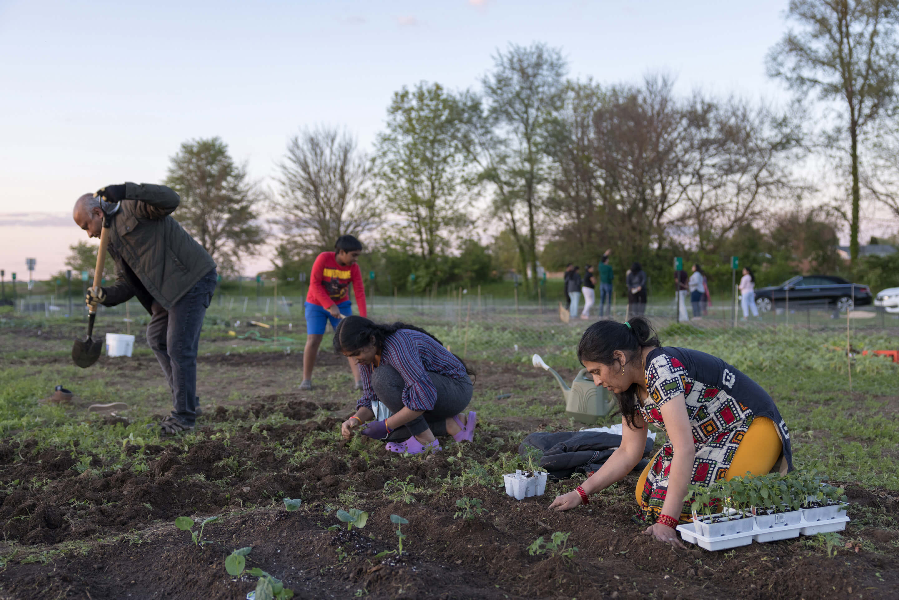
Schalliol’s work also addresses those controlled systems but instead focuses on how those systems produce interconnected landscapes and identities among middle inhabitants. His images of a community garden in Columbus show women crouched in the landscape, planting seedlings at dusk. “It was one of these places where people give so much love and care and attention to,” said Schalliol.
Yet he doesn’t see this scene simply as a pastoral moment; rather, it is a result of the same controlled waterways and logistics systems expressed in Hanusik’s infrastructure portraits. “The way that the community garden provides access to healthy food—foods that might not otherwise readily be available—these are all ways that people want to create new possibilities in the context of a world in which food insecurity is a major problem, in part because of the complexities of the supply chains that drive industrial agriculture,” he added.
Photographs of massive feedlots in the Texas panhandle juxtaposed against small, community-supported agriculture in Minnesota are, in his lens, products of the same system with vastly different outcomes, speaking to the middle’s different yet interwoven relationships with the environment, agriculture, and labor. These projects serve New Middles not only to illustrate the myriad ways the watershed is experienced from its north to south ends, but also to speak to what Zeiger calls the plurality of middle identity.
“The many middles that make up the watershed are strong enough in their own right,” said Zeiger, “that sense of multiple selves in solidarity with other cities in the middle, using culture to tell multiple narratives.”
Multiple identities, narratives, and experiences of these development systems that manipulate, enforce, and fail color the middle as a united front. Solidarity, then, becomes a force for the middle’s future, particularly as middle cities turn their energies and investments back toward their waterways. As we see places like Columbus, Memphis, Minneapolis, and Chicago pour enormous development efforts into revitalizing riverfronts within the Mississippi River watershed, Exhibit Columbus presents an opportunity to root those efforts in a grander context, beyond “amazing real estate opportunities,” postindustrialization, or placemaking. The exhibition is beginning those difficult conversations about considering our neighbors—no matter how far away—in those endeavors. “Exhibitions are almost an excuse for other things to happen,” said Gil. “Exhibit Columbus is that format to have those complicated conversations, but also is beginning to point at the foreseeable future.”