The Atlanta BeltLine, a transformative and ever-expanding rail-to-trail corridor stitching together a diverse patchwork of 45 disconnected neighborhoods in Georgia’s sprawling capital city, has launched a new mapping tool designed to “enhance transparency and improve equity in BeltLine investments.” Dubbed the Investment Data Explorer, the tool enables users to track said investments across five impact areas: housing, parks and trails, transit and streetscapes, economic development, and arts and culture.
By harnessing the mapping tool—or as Urbanize Atlanta has called it, the “gentrification-o-meter”—residents and stakeholders of neighborhoods located within the 22-mile BeltLine loop can more easily understand the changes underway in their own respective backyards. The BeltLine has been described as both the most comprehensive revitalization efforts in Atlanta and one of the “largest and most wide-ranging urban redevelopment and mobility projects” currently underway in the United States.

Atlanta BeltLine, Inc. (ABI), an economic development organization established in 2006, noted in an introduction to the Investment Data explorer that it “acknowledges the unintended impact of gentrification, rising housing costs and property taxes, and displacement of residents and business” inherent with such a geographically expansive undertaking. The agency also says it “recognizes the racial and economic disparities that exist around the BeltLine corridor” and that communities in the west and southwest experience “lower median household incomes, higher rates of unemployment, higher housing cost burdens, and greater reliance on public reliance on transit” than other neighborhoods linked to the historic rail system-turned-urban trail network. Spanning nearly 15,000 acres within the City of Atlanta, the BeltLine Planning Area consists of ten subareas, which include four Equity Priority Subareas that “appear particularly vulnerable to gentrification and displacement.”
The agency goes on to state that its approach to equity entails that all “legacy residents, new arrivals, and business owners—regardless of age, gender, gender identity or expression, sexual orientation, race and ethnicity, ability, income, or political ideology—benefit and prosper from the economic growth and activity associated with the Atlanta BeltLine.” The Investment Data Explorer is envisioned as a key tool in keeping data-driven tabs on this growth.
“Social equity and inclusion have always been at the center of the Atlanta BeltLine’s vision,” said Clyde Higgs, president and CEO of Atlanta BeltLine Inc., in a press statement unveiling the Investment Data Explorer. “This new tool is here to keep track and help us pivot if we need to as we continue our progress.”
“The goal is to demonstrate the Atlanta BeltLine’s progress and results over time,” added Higgs. “This information will help us as we continue implementing efforts around affordable housing, small business support, and commercial affordability, as well as our infrastructure.”
As noted by Urbanize Atlanta, the release of the Investment Data Explorer follows that of a complementary mapping tool first introduced in the summer of 2020. That mapping tool, the Demographic Data Explorer, tracks demographic shifts in BeltLine-adjacent communities including changes in population density, income, rent growth, and more. Both tools were designed to support “ABI’s equity and inclusion vision, inform the public, and promote transparency and accountability,” and developed as part of a “multi-phase partnership” between the agency and Neighborhood Nexus.
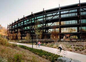
Last month, Alexander Garvin, an urban planner, architect, and educator whose landmark 2004 report commissioned by the Trust for Public Land played a key role in shaping the present-day BeltLine, passed away at the age of 80. AN last checked in with the BeltLine when Seattle-based Olson Kundig revealed its design for a mixed-use office complex rising at 760 Ralph McGill Boulevard, a 12-acre former industrial site situated adjacent to Historic Fourth Ward Park along the BeltLine’s Eastside Trail. Extending from Piedmont Park to the southeast Atlanta neighborhood of Cabbagetown, the 3.5-mile Eastside Trail was fully completed in 2019. The first completed section of the Southside Trail debuted this past October.