New York City–based landscape architecture and urban design firm James Corner Field Operations has shared further design details and a slew of new renderings of an ambitious plan set to transform the South Baltimore waterfront.
Dubbed Reimagine Middle Branch, the vision serves as park-studded connective tissue of sorts that fuses together 19 different neighborhoods with each other while also providing dramatically improved public access to over 11 miles of waterfront along the Middle Branch of the Patapsco River. Many of South Baltimore’s predominately Black and brown South Baltimore communities have been historically cut off from the shoreline, and by establishing a formal network of recreational destinations—parks, pedestrian trails and bridges, fishing piers, playgrounds, and more—Reimagine Middle Branch activates the long-underutilized “backyard” of these neighborhoods. In a statement, Baltimore Mayor Brandon M. Scott described Reimagine Middle Branch as a “key component of our larger strategies to revamp and reinvigorate recreation opportunities and outdoor spaces throughout our city.”
“This is about providing clean, accessible, and modern spaces that show our residents, particularly our young people, that they matter,” Scott added. “That we care about them and are going to do everything in our power to give them the best quality-of-life possible.”
Field Operations’ updated design plans were first unveiled during a February 24 public meeting hosted by the City of Baltimore, South Baltimore Gateway Partnership, and the Parks & People Foundation. As previously reported by AN, Field Operations replaced West 8 on the project in December 2020 five months after the Dutch firm, headquartered in Baltimore’s sister city of Rotterdam, formally withdrew. The year prior, West 8 had won an international competition to develop the sweeping waterfront revitalization with Field Operations placing second. (AN has published extensive interviews with both Adriaan Geuze, co-founder and design director of West 8, regarding his firm’s pulling out of the project, and with James Corner after it was announced his firm would be taking the reins.)
As noted in a March 3 press release, the updated plan’s recommendations fit within a framework of three guiding principles—Protect and Connect the Shoreline, Transform Barriers into Connections, and Strengthen Communities with Parks and Programs—while building upon several previous community-bolstering efforts and investments in South Baltimore neighborhoods that are planned, in-progress, or have been completed.
“The plan integrates physical planning with economic development that prioritizes job creation, entrepreneurism and increasing the future earning potential of local residents,” said Brad Rogers, executive director of the South Baltimore Gateway Partnership. “Alongside new public space amenities, we are equally focused on local workforce development and business incubation opportunities, such as green jobs involved in maintaining and monitoring the restored wetlands, and pop-up markets for local vendors.”
At the public unveiling of the new Reimagine Middle Branch plan in late February, the Field Operations-led design team shared its vision for three so-called “Priority Project Zones.” They are as follows:
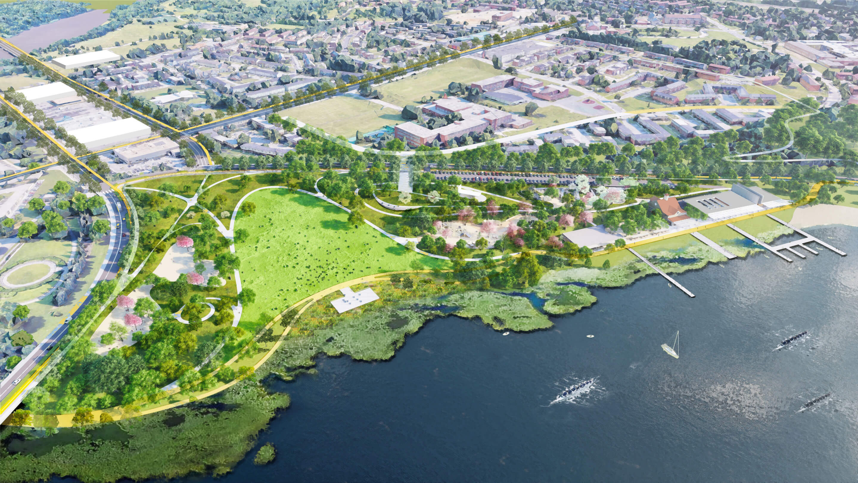
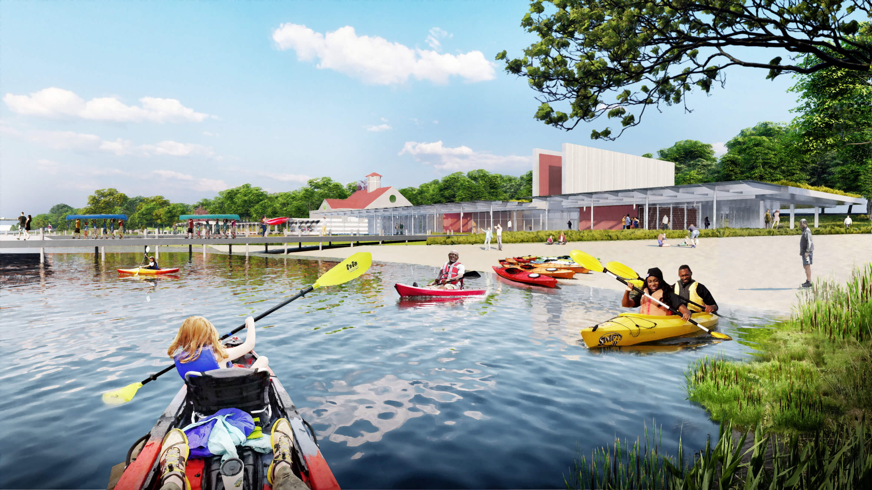
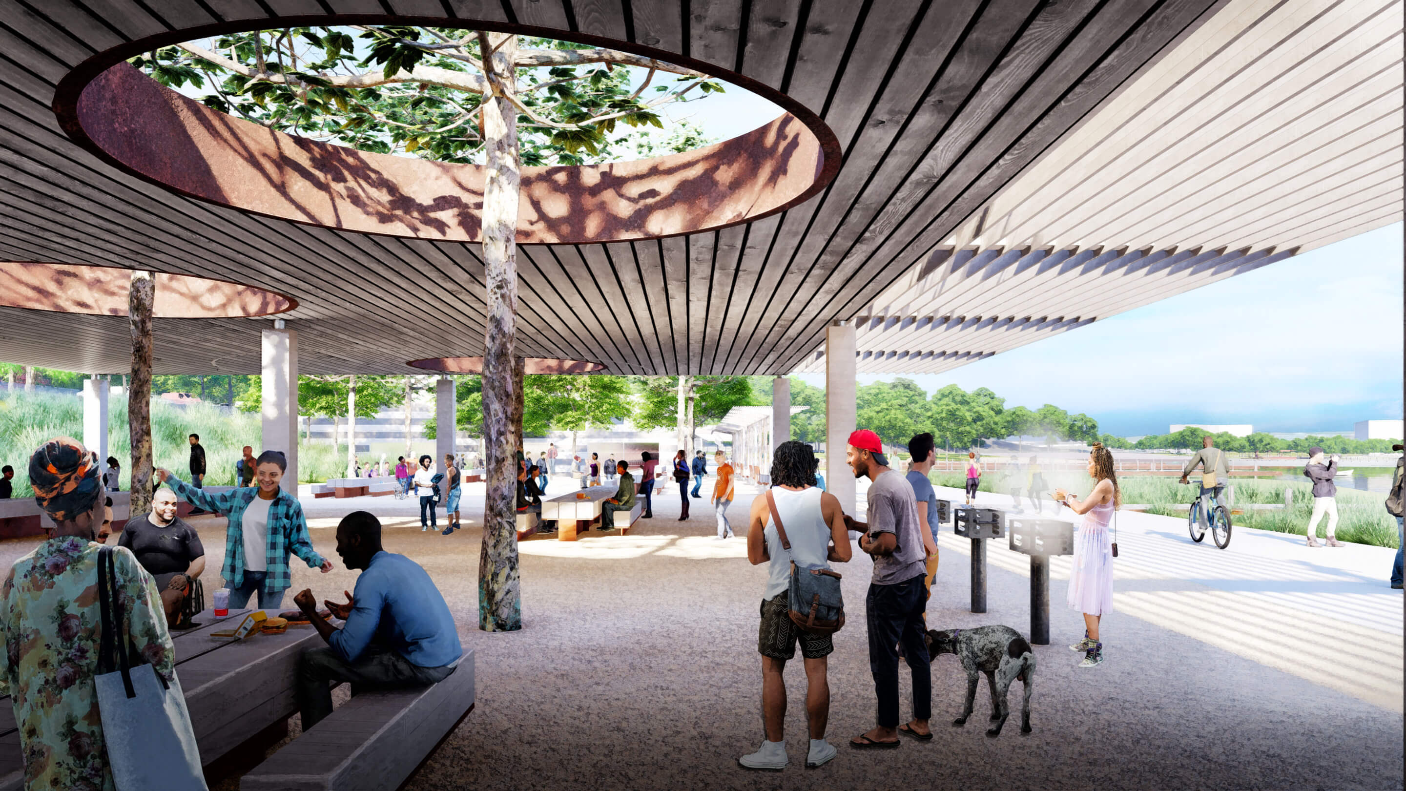
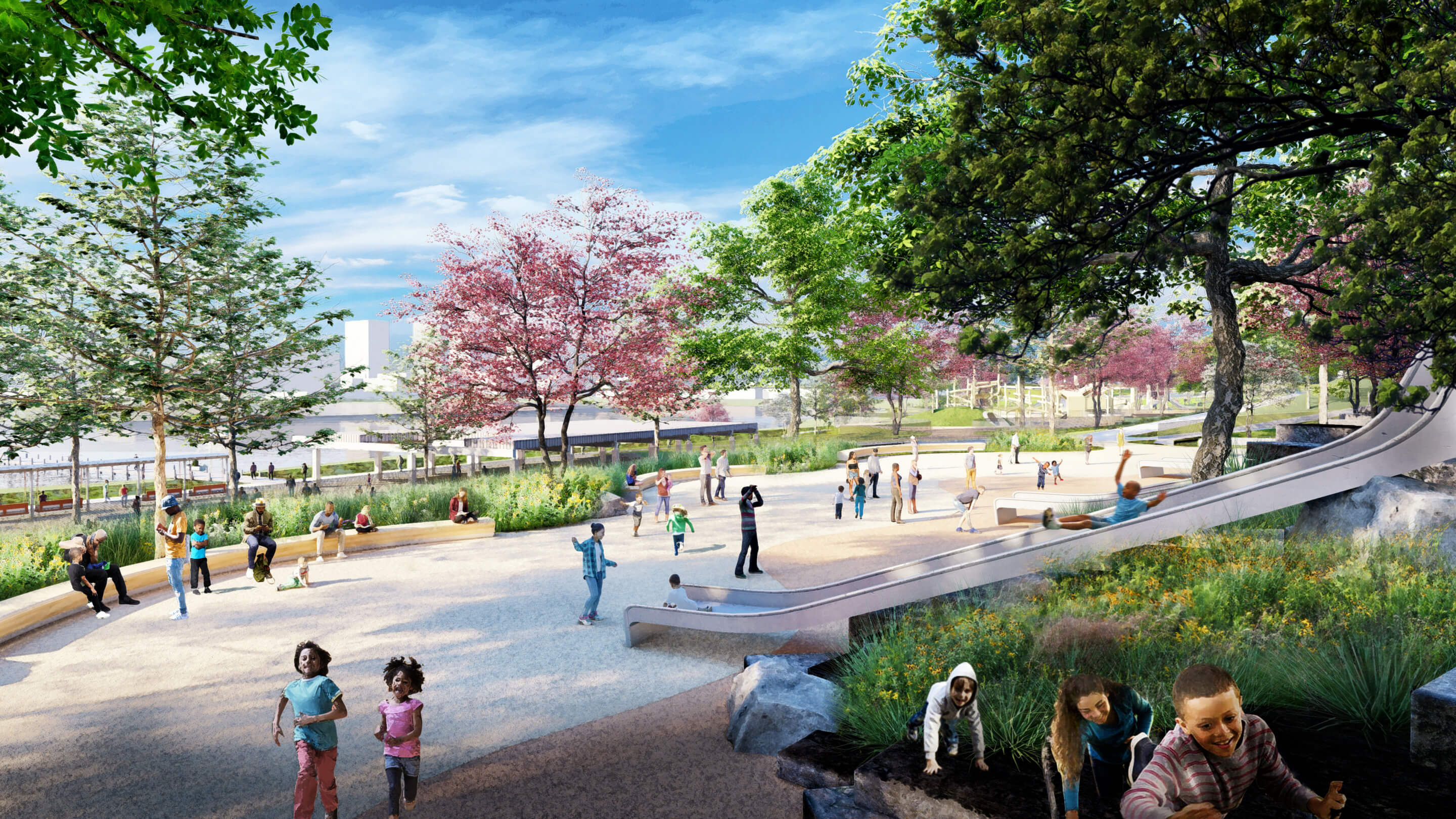
An expanded and revamped Middle Branch Park. Per the Reimagine Middle Branch plan, the existing 150-acre Middle Branch Park, which hugs the shoreline of the Patapsco River in the Cherry Hill neighborhood, would gain a slew of new amenities including a new boathouse, improved boating and fishing piers, a revamped playground, and a covered outdoor pavilion for gatherings. An expansive social hub, set to include a food hall or lively public marketplace, would replace the existing boathouse at the park.
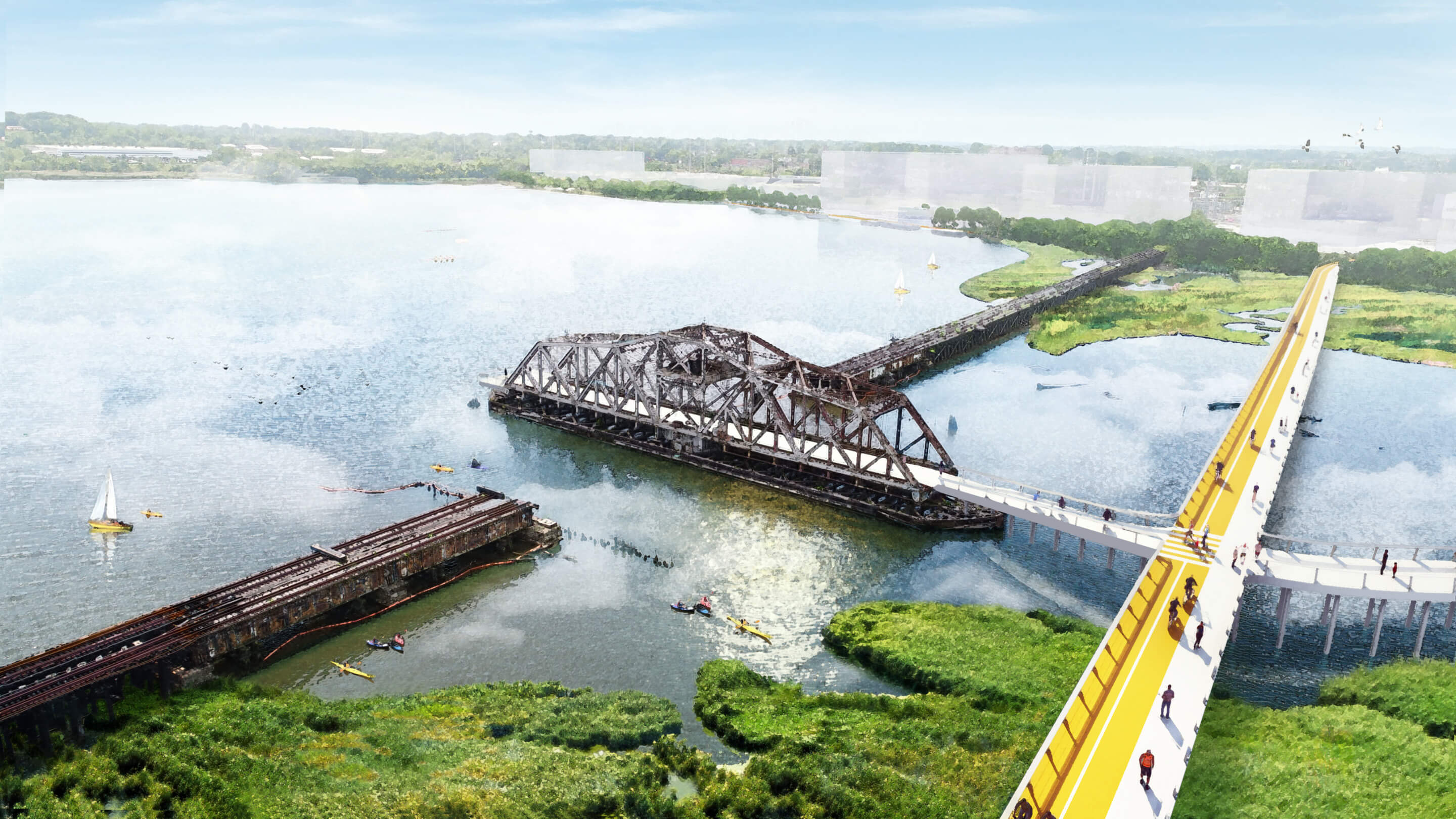
What’s more, work is currently underway along this particular stretch of shoreline to realize a boardwalk-flanked waterfront trail. Complete with designated pedestrian and cycling lanes, the trail will link the revitalized Middle Branch Park with the $23 million, GWWO Architects–designed Cherry Hill Fitness and Wellness Center at Reedbird Park, a new development in the Westport area, and other adjacent waterfront projects.
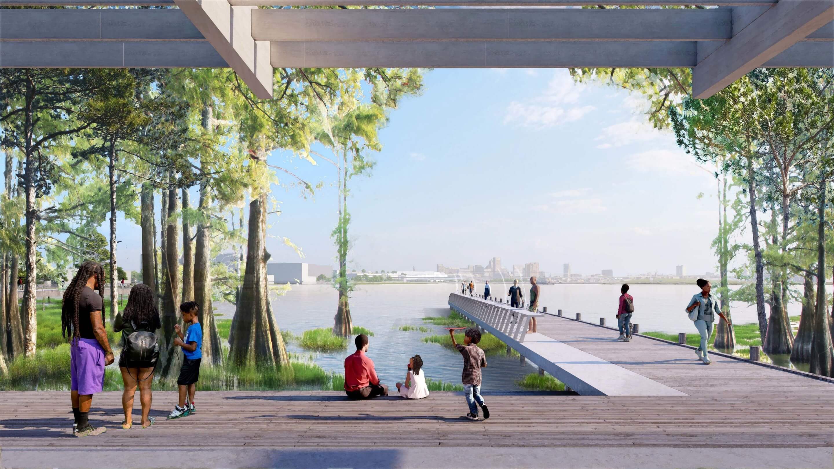
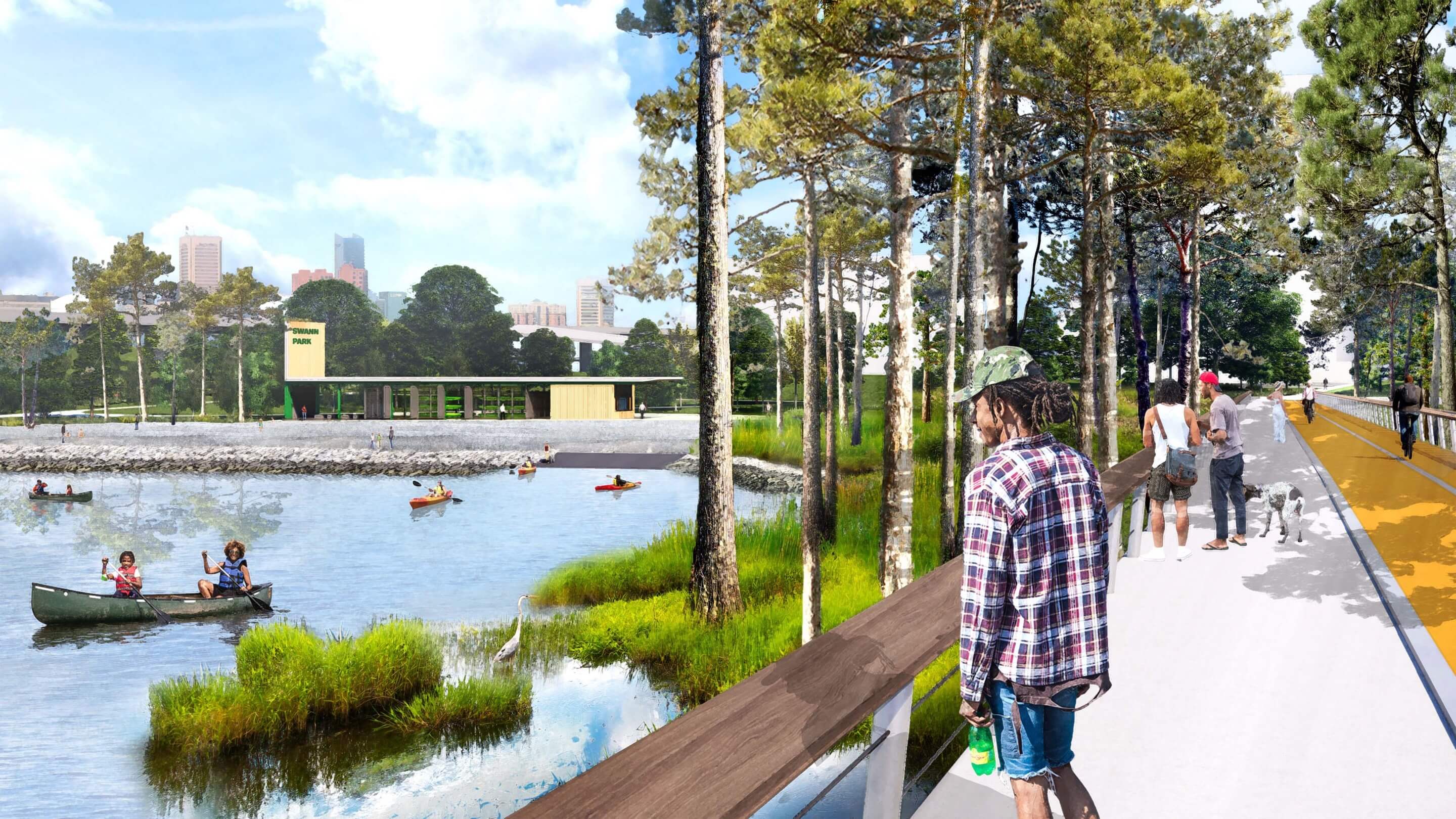
As envisioned, the park’s Middle Branch Marina would also be reimagined to include educational and recreational programming. (It’s currently home to a sizable live-aboard community.) Just west of the marina at Smith Cove, the plan envisions myriad new features including fishing piers, pavilions, a nature-based playground, and restored marshland. As the city explained in its unveiling of the plan: “Taken together these improvements comprise a significant, regional-scale park connected to neighborhoods south and west of the Middle Branch.”
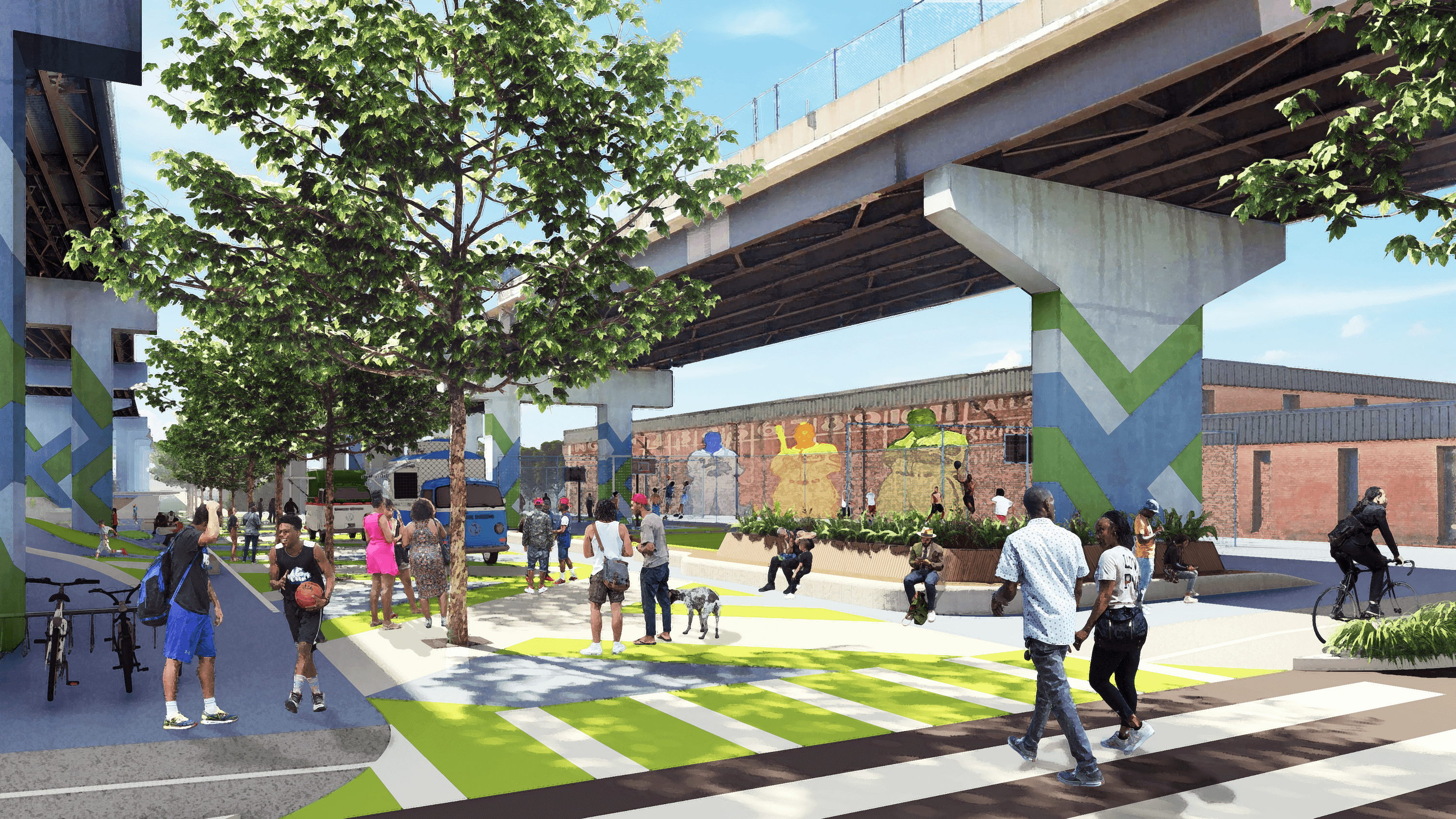
A second Priority Project Zone zeroes in on Ridgley Cove, where an expansive new maritime recreation area—one that serves double duty as a work of green stormwater infrastructure—will be created at the mouth of the Gwynns Falls. Fused together by a new trail network and an east-west pedestrian bridge linking the Westport and Port Covington neighborhoods, Ridgely Cove, as proposed, would gain a trio of new parks: Swann Park, which will feature, among other things, a public beach and dedicated canoe and kayak launch; Underpass Park, which would be tucked beneath Interstate 395 and include a skate park, sports courts, and more; and Black Sox Park, which would be located across the cove from Swann Park, and be home a number of recreational opportunities including a youth baseball field and marshland trails. The park is named after the Negro League Baseball team that was based in South Baltimore from 1916 through 1933.
The third and final Priority Project Zone is the Loop Trail, a major new pedestrian and cycling circuit that will link together the new waterfront parks and open spaces as proposed under the Reimagine Middle Branch Plan. In addition to fusing together these new waterfront amenities and the neighborhoods that flank them, the trail would also link to a number of existing trail including including Gwynns Falls Trail to the northwest and the BWI and East Coast Greenway trails to the south.
More on Reimagine Middle Branch, including a project timeline, forthcoming events, and a look at the full project team, can be found here.