Plans to redevelop the riverfront in Middletown, Connecticut, are a long time in the making. In 2014 the small New England city, population 46,406, announced its intentions to redesign its waterfront, imbuing life into the former industrial landscape. The Riverbend Master Plan announced in May 2021 selected New York City-based architecture and urban design firm Cooper Robertson to lead the project’s design, alongside engineering and environment services firm Langan and economic development specialists Karp Strategies.
Middletown is situated at the “bend” of the Connecticut River; the waterway has been a resource and linchpin for centuries, first for the Indigenous people who resided on the land, then later for European settlers, and also throughout the 18th and 19th centuries when it served as the state’s largest port used for industry and transport of goods. In the 1960s the town was broken-up by a car-centric urban renewal scheme that partitioned the downtown from the riverfront with the construction of Route 9, which also displaced minority and low-income residents.
“Since its beginning Middletown has relied on the river for its fortune. Now fortune impels us to plan for and protect the river, not just for commerce, but for enjoyment, contemplation, a sense of wonder and belonging,” former Mayor Maria Madsen Holzberg said in the Master Plan document.
For the last year the design team has worked closely with residents and other local stakeholders to develop concepts for the redesign. Over 1,200 comments were collected from the community during the consultation period, which involved hosting workshops and breakout sessions. The Main Street Market Gallery was used as a consultation space where the public could regularly learn about the project and submit feedback about the design.
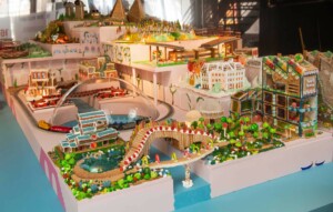
The resulting design comprises a multitude of programming supporting recreational activities, as well as commercial and residential developments, art venues, and several walking paths and park spaces.
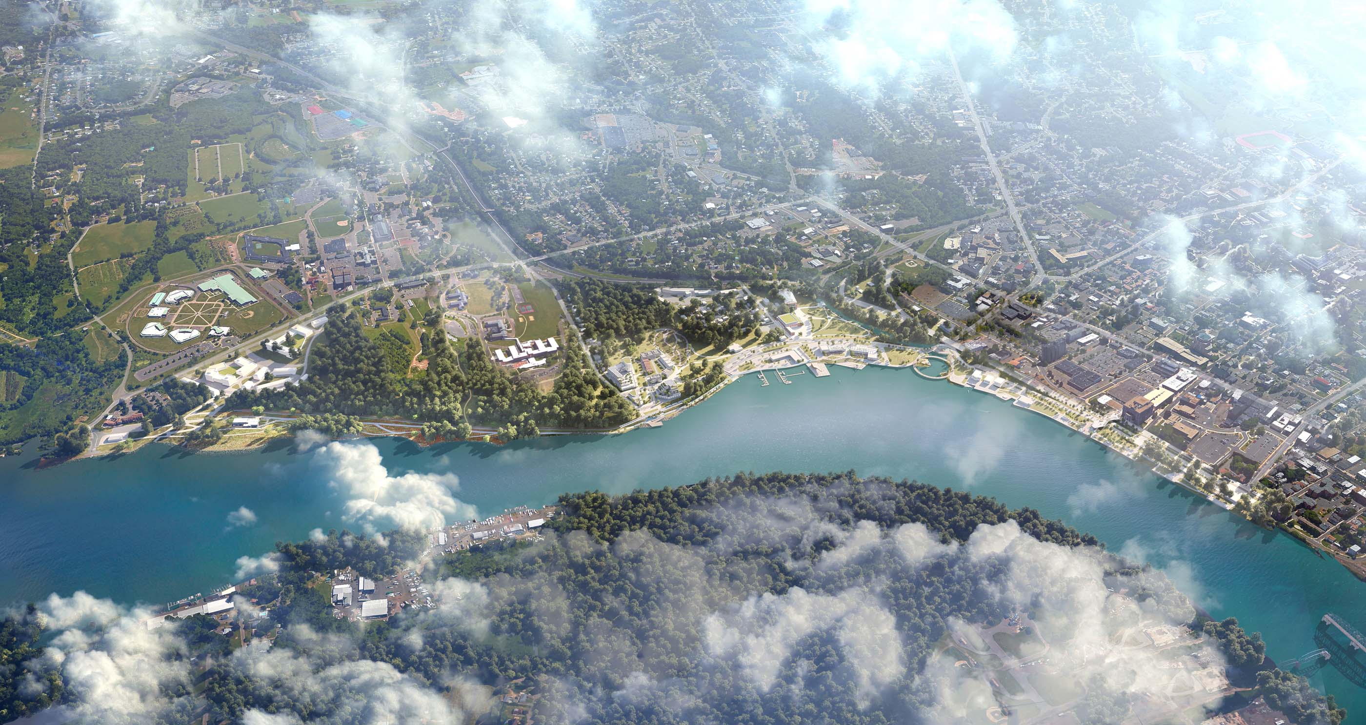
The redevelopment will span from Harbor Park, at the east, to the Connecticut Valley Hospital campus and Rushford Center, and will divide nearly 200-acres along the riverfront into four distinct “districts:” Riverside, Sumner Brook, Hillside, and the South End. Each new district will be developed with its own unique programming, much of which was taken from public input and ideas.
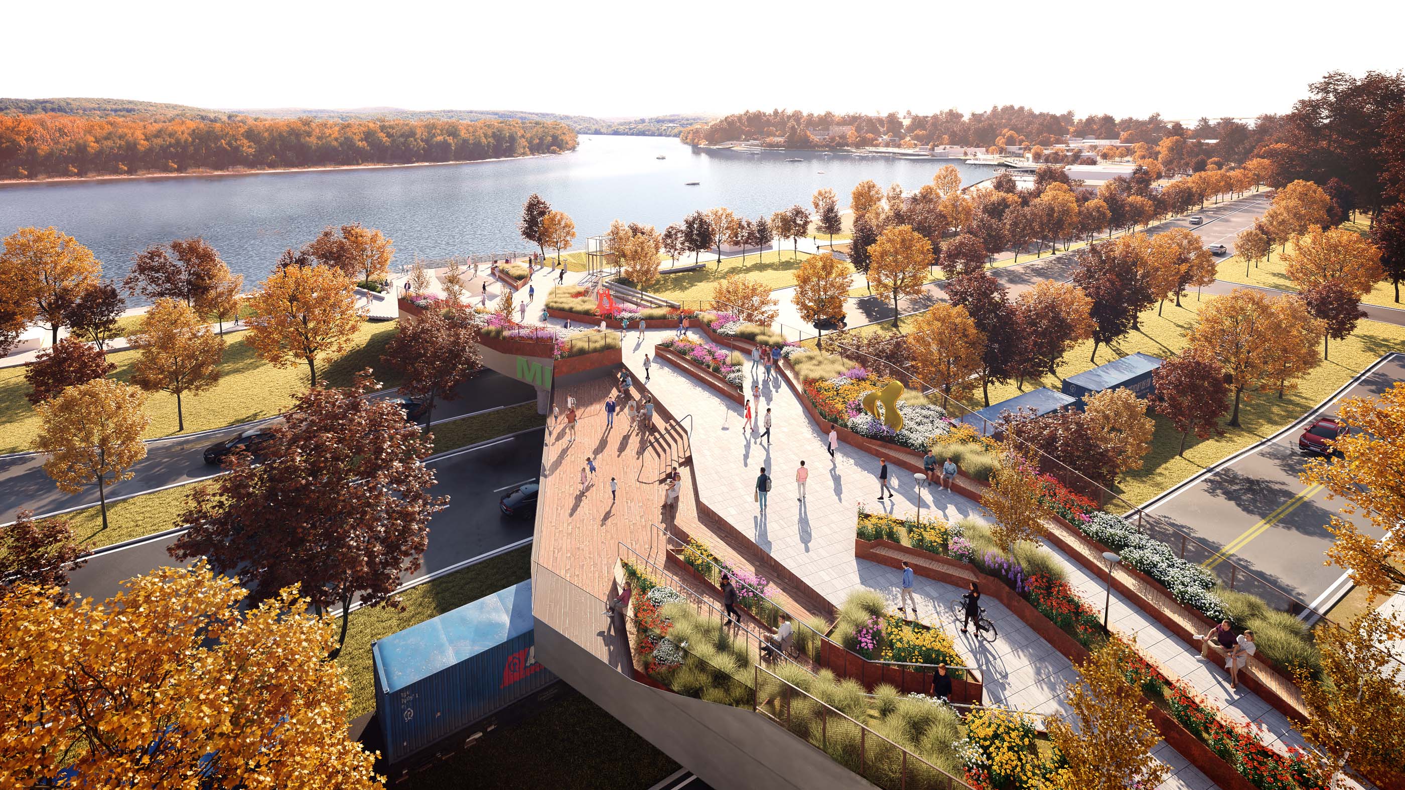
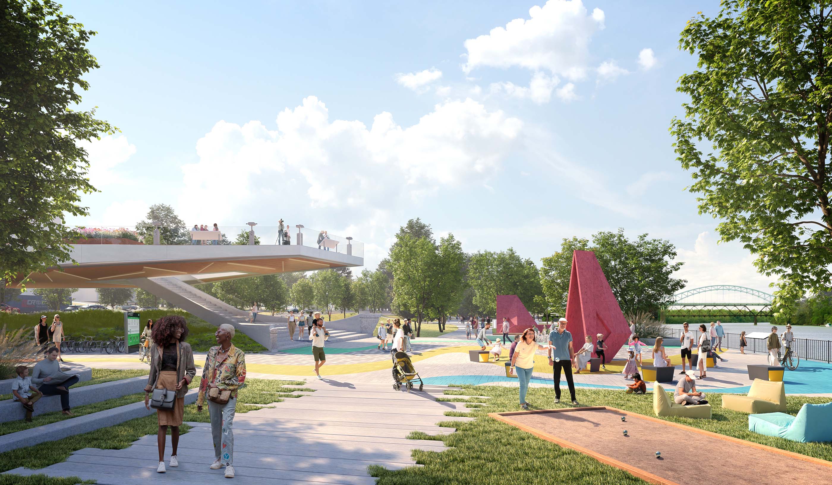
A focal point of the Riverside district is a new pedestrian bridge, activated with greenery and public art. It will straddle Route 9 to reconnect the river and the downtown. Center Street Pedestrian Bridge Plaza, a community-centered public square, will offer space for hosting events, seating, and access to the pedestrian bridge. The Sumner Brook district will reactivate industrial lots, transforming a swath of disused land into mixed-use riverfront developments. Similarly, the South End, the site of former well fields and an aquifer, will be redeveloped to accommodate more housing. The Hilltop district, primarily state-owned land, will be enjoyed for its natural beauty.
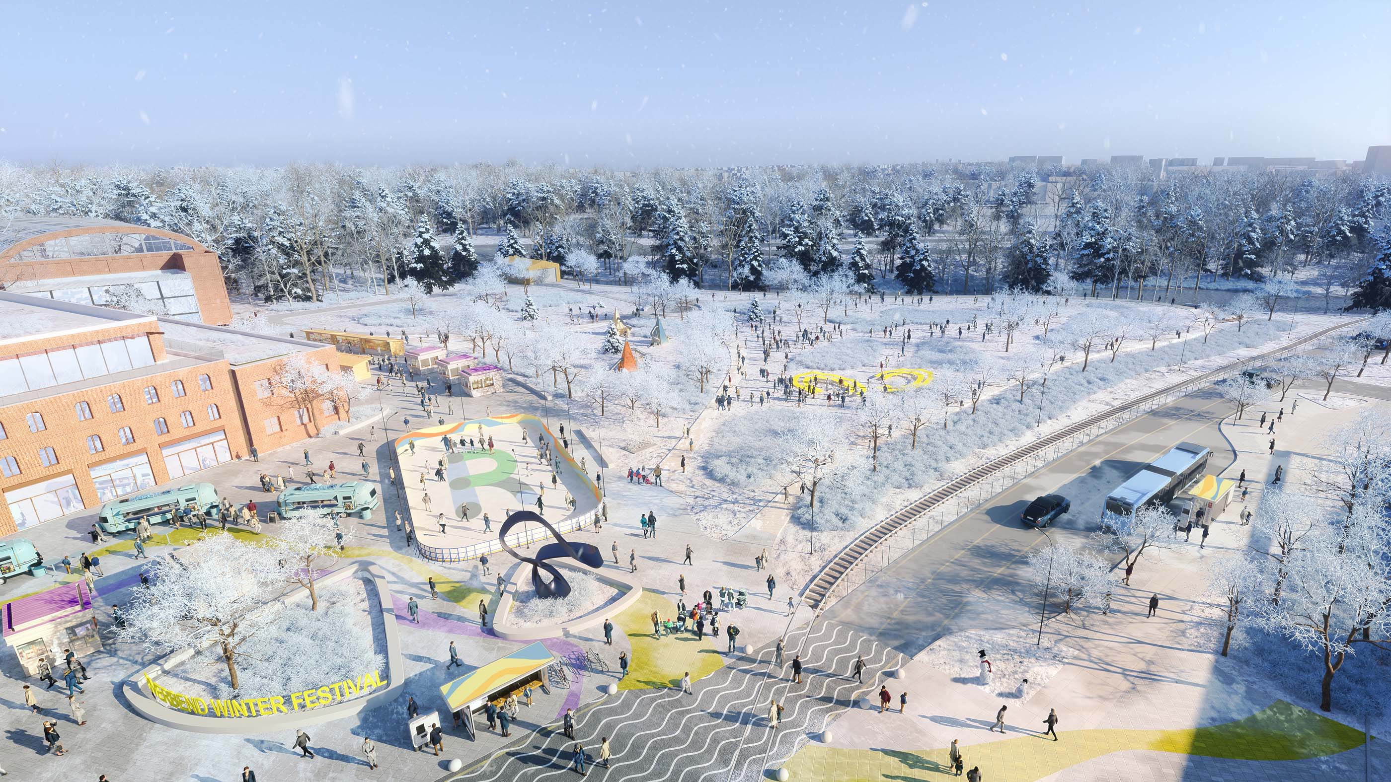
Other key components of the master plan include the new Riverbend Nature Park, a four season park located in the Sumner Brook flood zone. A recreation center, playgrounds, walking paths, and paddle boats will activate the park all year, while in the winter months an ice skating rink, outdoor market, and sledding trails will offer community-focused leisure. At a later stage of the project the former industrial buildings on the site may be adapted into parking garages or commercial spaces.
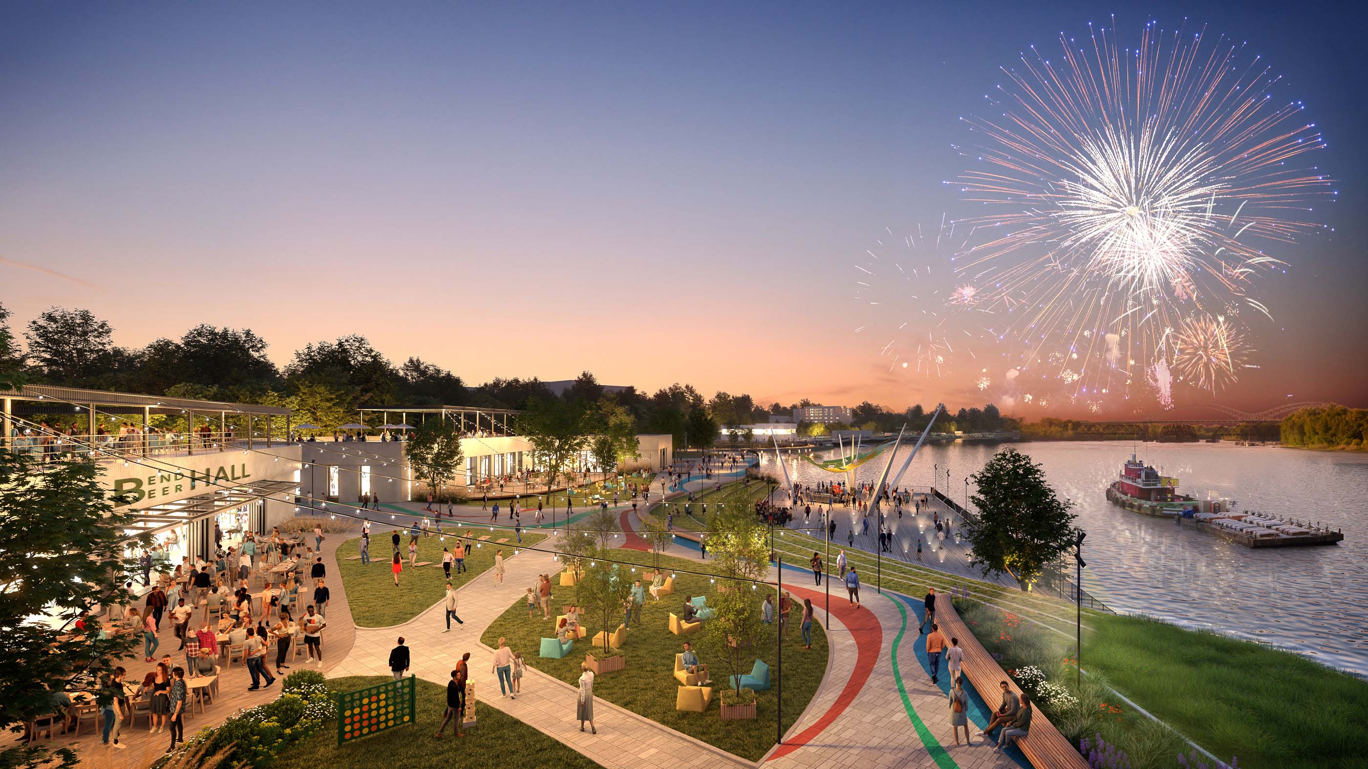
Adjacent to the park is Riverbend Landing, a former wastewater treatment plant that will be transformed into a culture and entertainment destination with restaurants, retail, and amphitheater.
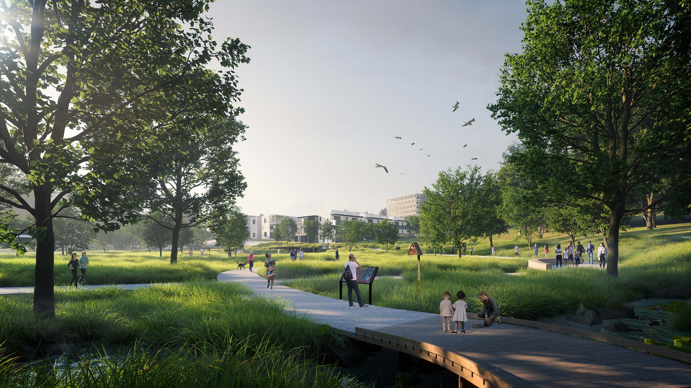
To pay respect to the local Indigenous group, the Wangunk, who had originally settled along the river, the master plan has included a concept for another park—The Sowheag, named for the tribe’s political leader, which will redesign the wetland into a “restorative escape” with an elevated walkway and renewed landscape, ideal for hosting educational programming focused on wildlife.
Another nod to the site’s Indigenous history will come in the form of a monument. The erected ring-like sculpture, located within the Union Street Gateway plaza, will pay homage to the tribe and its contributions to the local community.
The Union Street Gateway is an iconic new arrival point to the riverfront. It features walking paths, boat access to Sumner Brook, and a memorial plaza honoring the Wangunk tribe.
Next steps in the plan’s implementation will involve assessing and updating the current zoning regulations and framework, which are “outdated” and present “a barrier” to the proposed redevelopment. Further coordination will also happen with city officials concerning how to incorporate private development.
The full master plan can be viewed here.