The Constant Future: A Century of the Regional Plan
Vanderbilt Hall, Grand Central Terminal
New York, New York
Until October 24, 2022
Nearly 100 years ago when the Regional Plan was first presented it was novel, nothing of this scale had been done before. It introduced a vision for what is today the modern definition of a city and forged New York City as the crowning, model example of a developed metropolitan area. The plan promoted new concepts such as suburban expansion, mass transit, highways, and high-rise developments. The Constant Future: A Century of the Regional Plan, an exhibition now on view at Grand Central Terminal’s Vanderbilt Hall, the history, present, and future of the Regional Plan Association (RPA) is on full show.
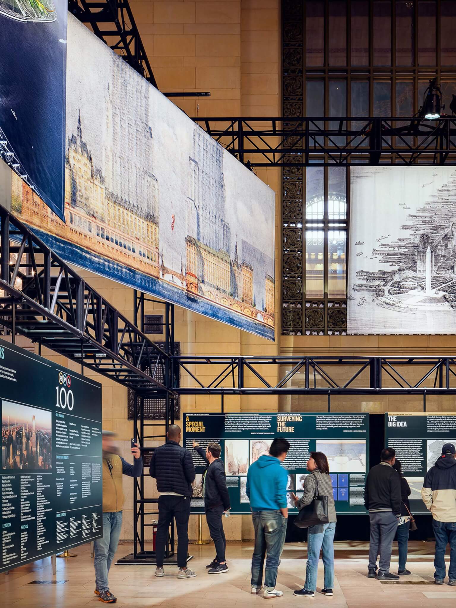
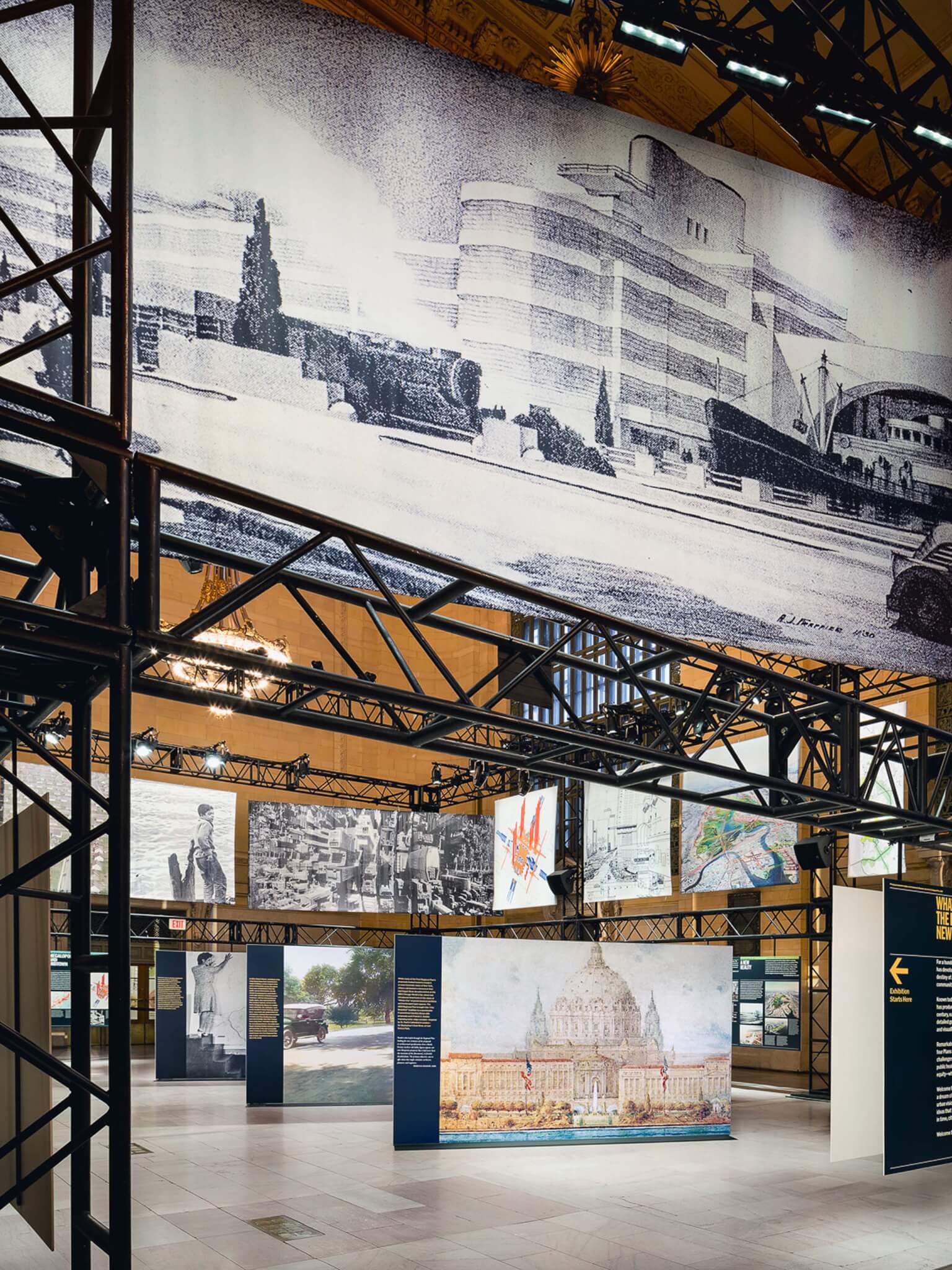
There is likely no better location than Grand Central for this extensive historical and archival showcase of the RPA’s story to be told, as the transit hub itself is an emblematic representation of the plan, a microcosm, if you will, where suburban and urban meet, where the modernity of the past is still giving way to modernity yet to come.
The Constant Future: A Century of the Regional Plan expertly details the RPA’s foundation in 1922 and provides a historical account of its work. The nonprofit association is not a government body, but rather for a century now has played an advisory and advocacy role in the development of New York’s urban fabric, regularly producing plans that outline the city’s potential future.
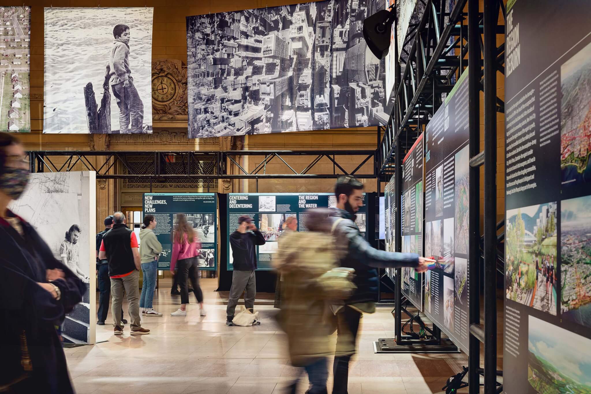
The show, a set-up of large almost billboard-like designs featuring text and images—primarily maps, diagrams, and photography taken from the RPA archive—is chronologically organized within the commuter train hall as a hanging encyclopedia. Given the building’s landmarked status, exhibition designer and curator James Sanders Studio and the RPA erected a metal truss structure and placed it within the center of historic Vanderbilt Hall to hang the materials from. The exhibition is divided into four sections based on the four regional plans drafted to date, with a bonus fifth section detailing the current work of the RPA.
The first plan was developed in 1929 and outlined a network of roadways and transportation lines extending outward from the city. Many of the proposals and ideas were quickly adopted and realized by a figure New Yorkers are well acquainted with: Robert Moses, the infamous urban planner and public official credited with designing many of the region’s roadways and neighborhood-shattering urban renewal projects.
The subsequent second plan, published as a series of reports, came 30 or so years later in the late 1960s. It built on what had already been completed and identified and solved issues that had arisen over the years as a result of suburban expansion. Now with nearly half the population residing outside of the city limits, manufacturing jobs in New York City had declined leaving large swathes of unused land primarily at the waterfront. Similarly, car use had only proliferated, cementing the need for a robust transportation network of subways, buses, railroads, bridges, and tunnels, which eventually fell under the purview of the Metropolitan Transportation Authority, established in 1965.
In it’s third iteration, published in 1996, proposals in the plan included large-scale development works such as an integrated railway network that would bring together the Long Island Rail Road (LIRR) from the east and the Metro-North and NJ Transit lines from the west and developing one of the only remaining unused plots in the city, a parcel of land in Midtown abutting the Hudson River. To the casual New York viewer these projects will ring familiar. The former proposal will partially open this winter when LIRR trains pull into platforms at Grand Central for the first time; the latter vision eventually evolved into what is now Hudson Yards.
The most recent, fourth plan, published in 2017, came at a turning point for the city. Much had occurred in the past two decades since the previous plan. Lower Manhattan was shaken and shattered by 9/11 and climate change reared its ugly head as Superstorm Sandy proved in 2012. Designing a resilient city with upgraded infrastructure, strengthened flood mitigation, and access to safe, healthy public space for all was paramount and remains a priority for the RPA and the city.
So many of the ideas put forth by the RPA once seemed far-fetched, even impossible because they were too large or required too much money, time, or planning. Yet so many of the visions were realized and are still to this day coming to fruition, albeit slowly. While a map itself is a static representation of data on a place as it was, as it is, or as it will be, the Regional Plan is evolving. Through maps and diagrams, it is a telling reminder of where we came from and where we are headed. What is particularly striking about the Regional Plan is how little has changed over the course of a century. The priorities (and challenges) of yesterday—mass transit, traffic congestion, waterfront development, affordable housing, just to name a few—continue to take precedence, adapting and expanding in scope over the years. And that’s the thing about cities— they were always designed for movement, they were designed to constantly evolve.