Topographies: Aerial Surveys of the American Landscape, published by MACK, presents new drone photography from Stephen Shore of landscapes across the United States, including locations in Montana, North Carolina, and New York. Accompanying the imagery are essays penned by Noah Chasin and Richard B. Woodward.
Chasin’s text, titled “Where Do I Belong Up Here?”, is excerpted below.
Stephen Shore has in a sense been practicing—and practicing for—the series of photographs collected in this book throughout his whole career. His engagement with the built landscape of the United States began in the late 1960s. Consider the work he made on a cross-country road trip in the summer of 1975 for Robert Venturi, Denise Scott Brown, and Steven Izenour for their exhibition Signs of Life: Symbols in the American City. We rightfully celebrate Venturi and Scott Brown for their simple yet transformative observation that so much more can be learned about a culture from observing the mundanities of quotidian life than from scrutinizing intentionally hubristic monuments to human achievement. Shore’s collaboration with them was inevitable, as he already had come to similar conclusions through his own work: subjecting that which appeared seemingly unremarkable to an elevated degree of intense, protracted scrutiny. Over the following years, he explored and developed this project through a range of photographic formats and bodies of work, including a decade-long meditation on the American landscape and a revelatory series documenting the gradual modernization of the Yucatan Peninsula.
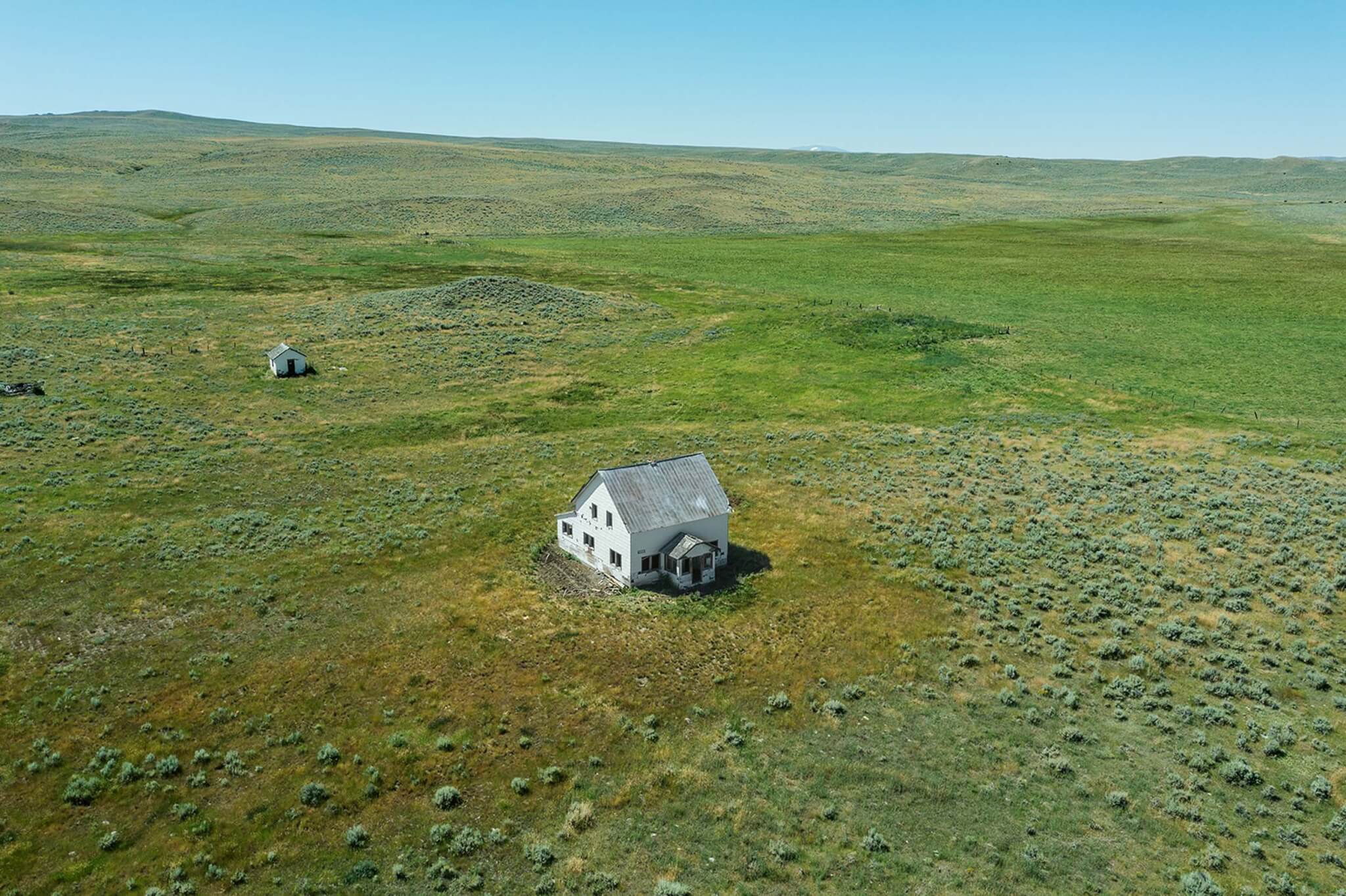
After so many years of working with a standard handheld or tripod-mounted camera, Shore realized yet another limitation of the apparatus: that the totality of what he wanted to see was regulated by positionality. The long, isolated days of the Covid pandemic, many of which he spent in Montana, afforded him the time for extended road trips in a car in whose backseat sat a high-quality, commercially available drone made by DJI, a Chinese tech company. Having recently acquired the storied Hasselblad brand, DJI drones currently feature a default onboard Hasselblad camera. An app downloaded to one’s smartphone maintains the drone’s location and functional status; it also monitors FAA regulations to determine where (and where not) it is legal to operate a drone. A small handheld unit with joysticks and a trigger for the camera completes the setup and allows for the intricacies of control. Then comes the hard part.

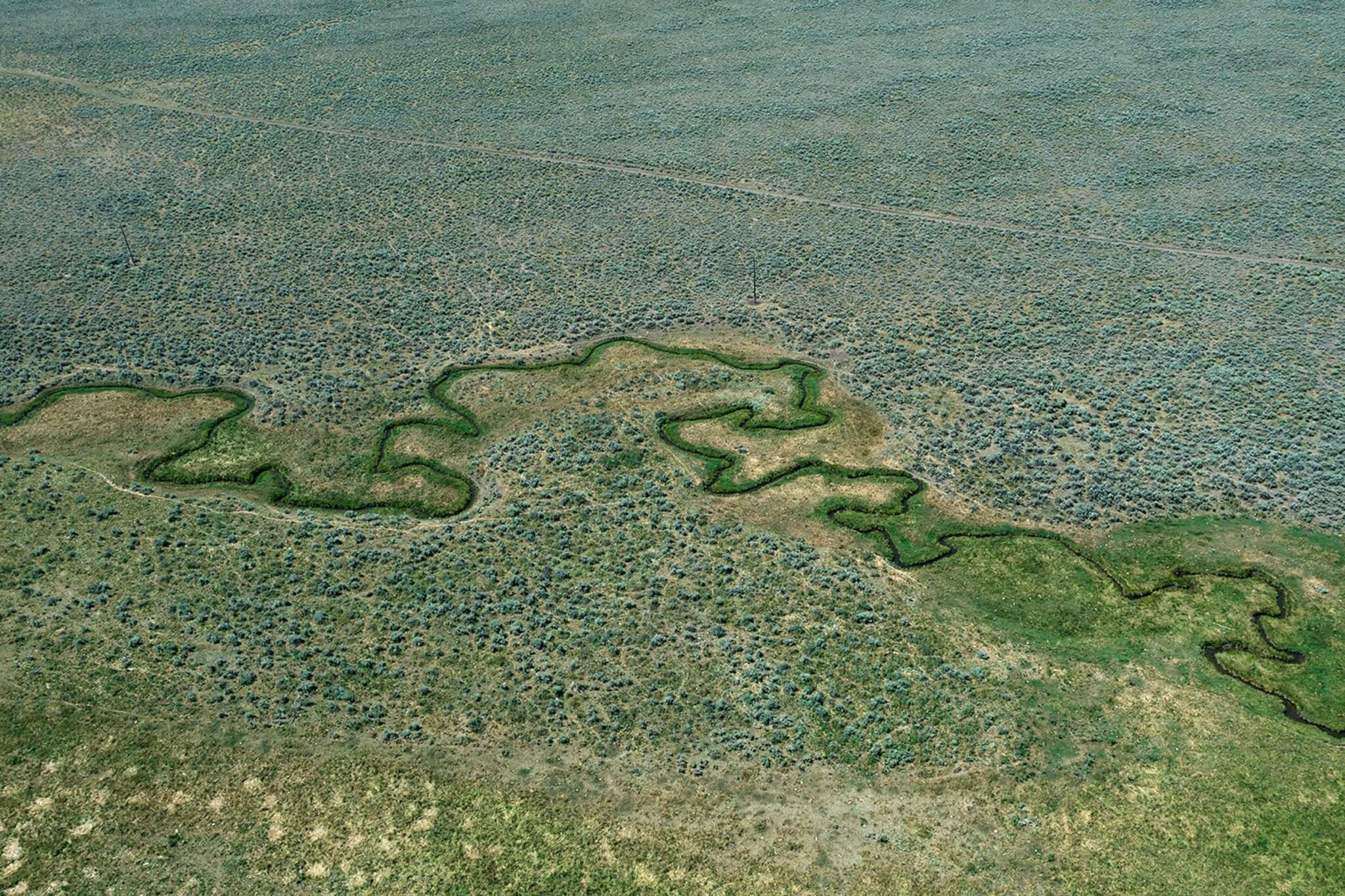
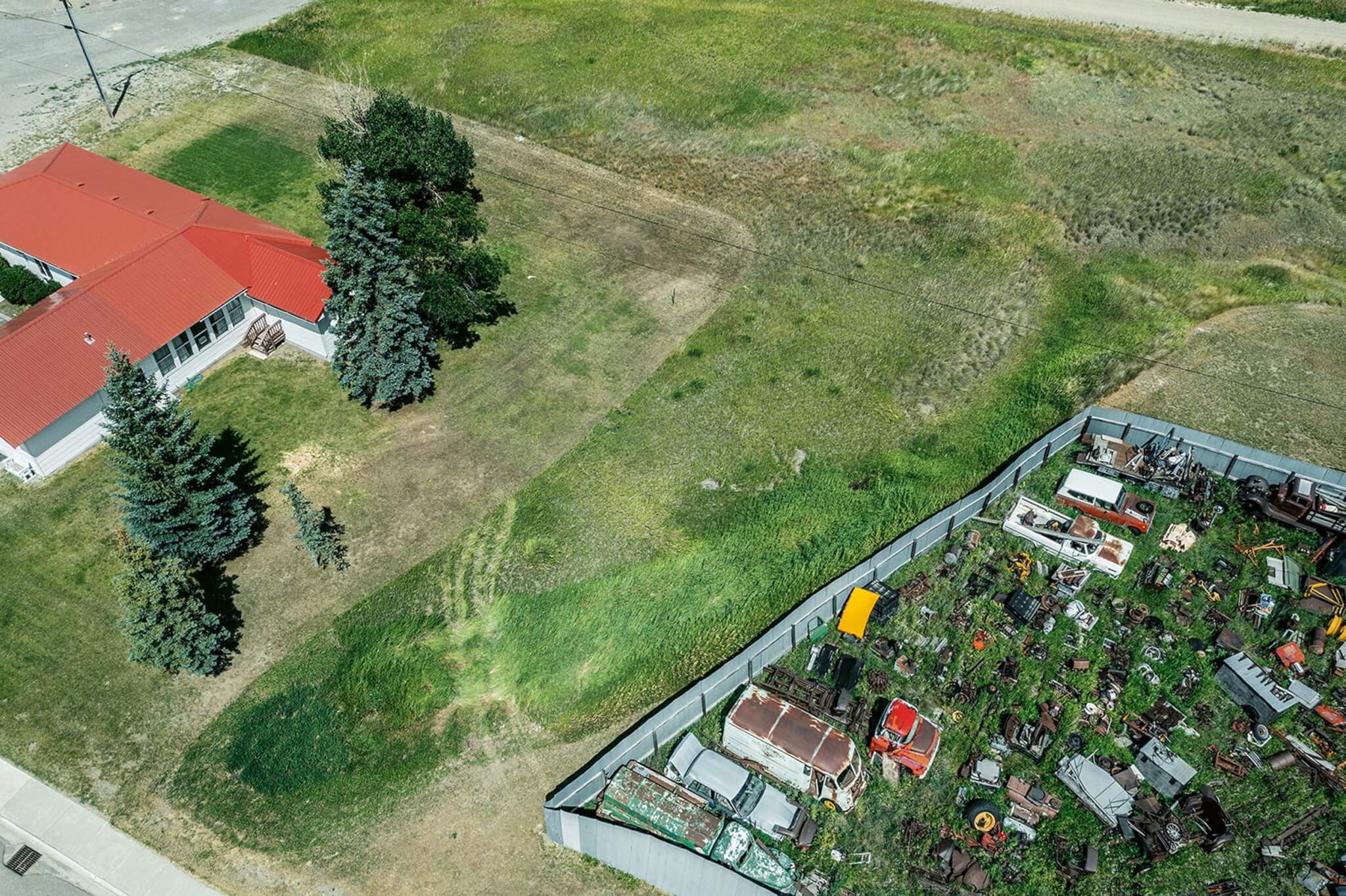
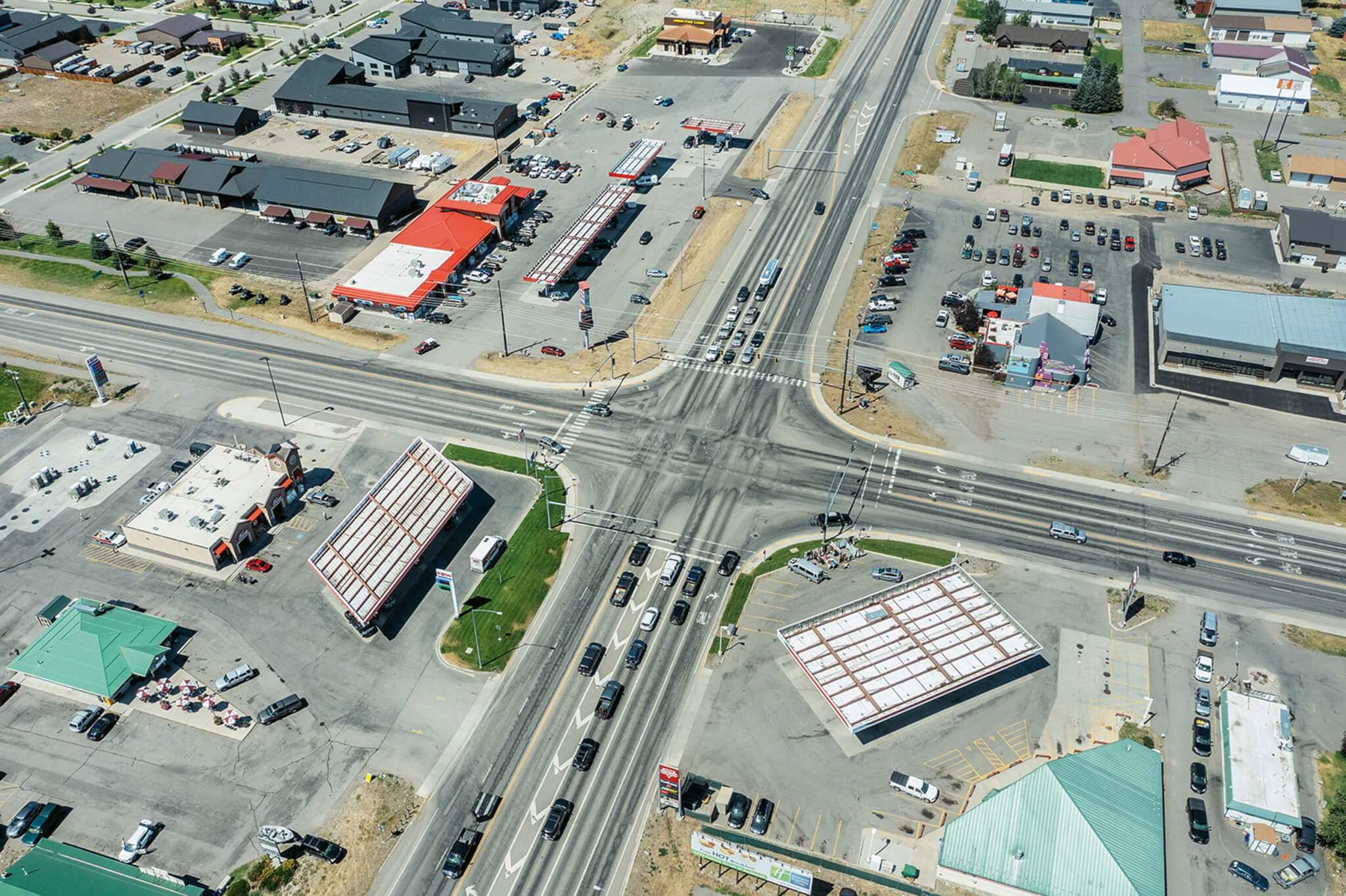
At a certain height, one can begin to comprehend adjacencies within the landscape, the manifestation of borders between one thing and another: a plot of open land occluded by a human-made structure; a tree canopy ceding its dominion to a body of water; the agonizing violence of a resource extraction facility against the backdrop of a stunning vista. Contemplating Shore’s drone photographs lands us amid a debate around the current definitions regarding what we might call the constructed landscape. Many disciplines—academic and otherwise—have heeded the call to reevaluate how we contemplate the relationship between two facets of the earth’s surface: those that bear the marks of human intervention, and the seemingly unmediated expanses that we might describe as “as-yet-unbuilt,” those that are waiting to be gobbled up by civilization’s insatiable appetite. Urbanists such as Neil Brenner argue for the notion of a “planetary urbanism” to define the aggregation of the manifold systems of surveillance, extraction and exchange, interconnectedness, and communication technologies. Taken together, all these suggest that the historical category of “the city” must be reevaluated to encompass our increasing reliance on the earth’s lithosphere, atmosphere, biosphere, and hydrosphere.
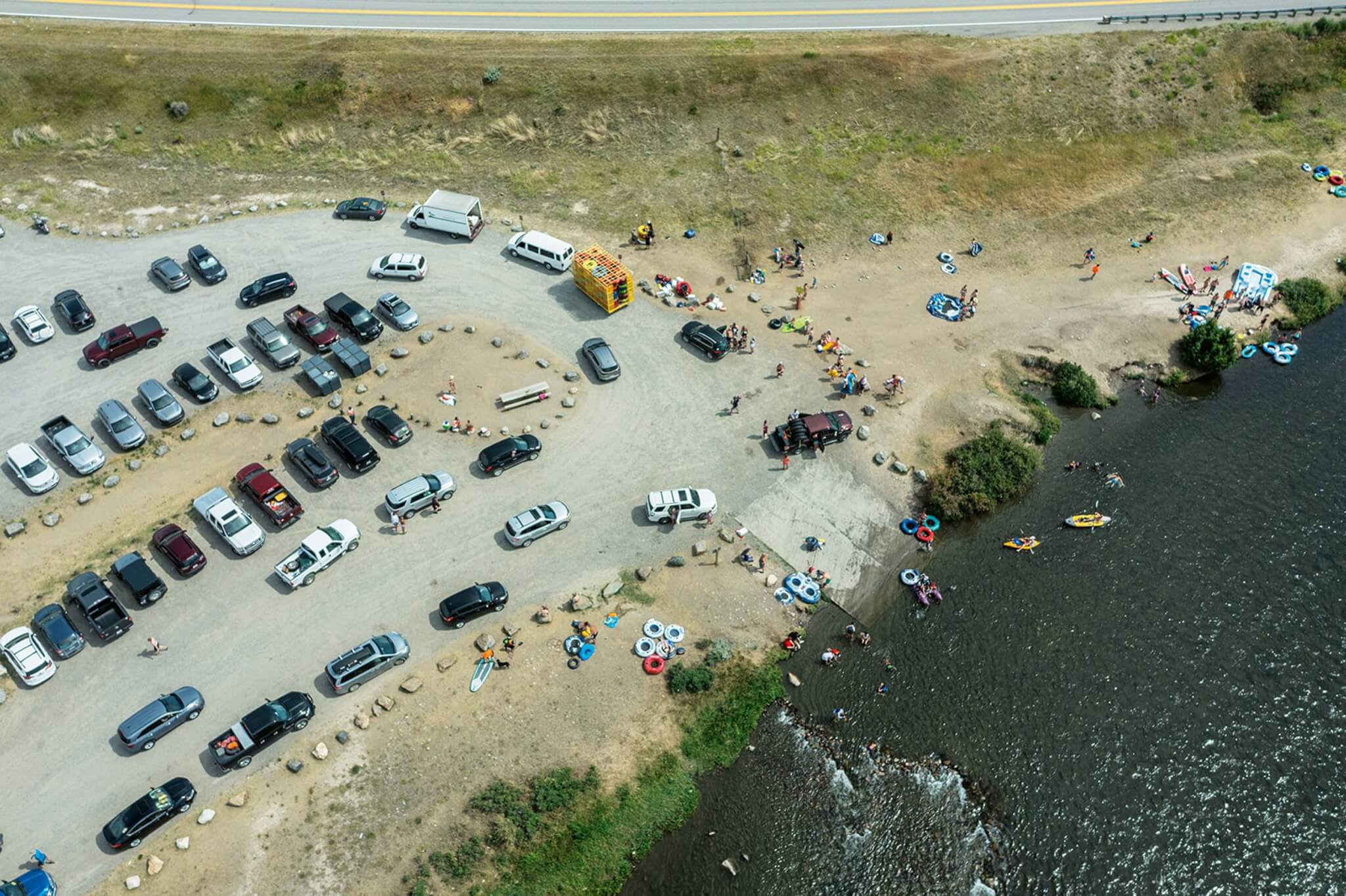
Shore manages to capture isolated and poignant moments amid the incomprehensible vectors of exchange in which we daily are enmeshed. While his images are notionally related to those satellite images that constantly surround us and describe our placedness, they are far more thoughtful and deliberate. They are fixed: our hearts and minds are allowed to stop racing for a moment; no “plus” or “minus” buttons allow us to zoom in or out, we have no cursor to swing the compass wildly in all directions. Like the drone itself, which in ideal conditions hovers above the terrain as stable as if it were affixed to a tripod, our viewing of these works is durational and contemplative. Naturally, Shore wanted to maximize the efficiency of the technology and quickly discovered that printing the drone-captured images in a high-resolution 18 x 27” format was the largest he could go before compromising the images’ integrity. As in Kurgan’s work, the technology used is remarkable if still restricted. Like a designer of the built environment limited by natural and manmade boundaries, by juridical and proprietary constraints, the artist recognizes when to abdicate control and allow those thresholds to assist in defining the work while knowing that sometime in the future all the rules will change.
Noah Chasin is an adjunct associate professor of Architecture in the Urban Design program at Columbia GSAPP.
Topographies: Aerial Surveys of the American Landscape (2023) by Stephen Shore, published by MACK, is available now.